One challenge stands out as we navigate the 21st-century urban jungle: problems related to the lack of space in megapolises like New York or Hong Kong. This consequently poses certain challenges for urban planners as they have to come up with some sort of fix for the increasing population in cities and the limited space. And here comes the building information modelling (BIM) technology that has brought a revolution to urban development.
Let’s delve into how BIM addresses these space constraints and why it might be the answer to the modern city planner’s prayers.
Table of Contents
The Digital Revolution in Urban Planning
BIM, or Building Information Modeling, is an innovative new way of approaching the city design process. It has integrated digital elements into this previously physical world. Contrary to conventional two-dimensional drawings, BIM provides a three-dimensional, virtually constructed model inclusive of extensive information about the building. This shift is not about switching eyes; rather, it is the real game changer.
Visualization
Unlike traditional two-dimensional platform planning, BIM offers planners and other stakeholders a much more advanced 3D platform, which makes it much easier for people to talk and plan.
Data Integration
Processing and interpretation of complex data from many sources are accomplished smoothly, which, in effect, speeds up otherwise time-consuming processes and leads to improved decision-making.
These features are especially useful in high-density urban areas where squeezing every last square inch of usable space is not out of the question. They help prevent areas from remaining empty while coordinating and planning developments.
Tackling High-Density Challenges
As it has already been extensive, urban density brings specific problems, the most important of which is the proper use of the most significant space. This is because extended conventional planning techniques do not efficiently capture the interest in a piece of land as they neglect the potential of available land. That is a realm in which BIM excels. Here are several ways BIM addresses space constraints in high-density urban development:
1. Maximizing Space Utilization
Each inch of space can be well-planned due to the 3D models that BIM provides for urban planners. Computers allow planners to plan each area of a structure in detail, and the interior and exterior shapes are made. This is important, particularly in crowded urban centres where vertical growth is often the only option.
2. Retrofitting Existing Infrastructure
Density should not only be created in new buildings. There should be intervals when one has to adapt a particular structure and retrofit it, in essence. This is easy in BIM due to the creation of precise models of existing structures, which present enhanced improvement possibilities. These models can aid planners in identifying idle spaces and how they can be creatively tapped; the older structures can thus be put into proper use once more.
3. Enhancing Collaboration and Reducing Errors
In dense urban developments, the stakes are high, and errors can be costly. BIM’s data-driven approach minimizes mistakes early in the planning stage. By integrating various data points and visualizing the project in 3D, planners can detect and rectify errors before construction begins, saving time and resources.
4. Improving Collaboration and Communication
Urban development is often a multidisciplinary effort involving architects, engineers, city planners, and stakeholders. BIM provides a unified platform where all parties can access the same up-to-date information. It fosters better collaboration, significantly reducing the chances of miscommunication and project delays.
Smart Cities: A Blueprint for the Future
BIM is not simply an application applied only to a specific project, but that is the foundation for building smart cities. Using BIM in conjunction with IoT in cities makes it possible to create smart structures, improve traffic organization, and improve public services. For high-density areas, this means:
Efficient Transportation Systems: This enables the planners to prescribe flow and congestion of traffic whereby the traffic flow simulations promote the construction of better networks and functionality of transport systems.
Intelligent Public Spaces: Instead, cities can coordinate the design and construction of parks and other public spaces, which shall be able to change to fit within the urban environment and be of usefulness to the people.
Sustainability: A Core Component
The following facts show that sustainable development is one of the greatest benefits of utilizing BIM in high-density urban development. The latter refers to the fact that cities are gross emitters of carbon — cities alone contribute to about 70% of total carbon emissions, while the construction sector contributes about 40%. With increasing populations in the cities, the demand for natural resources is normally felt. BIM helps alleviate this stress through:
Early Error Detection and Waste Reduction
Energy Efficiency
BIM will have the capability to study the different characteristics of buildings to advise on possibilities of improving energy consumption. In selecting what materials to use and how to best align the building to encompass the natural resources, BIM makes every construction as environmentally friendly as can be in the initial stages.
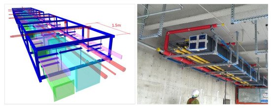
Real-World Applications: Case Studies
The Road Ahead
Conclusion
Building Information Modeling BIM is a powerful solution to the spatial challenges faced in high-density urban development. Its integration into urban planning improves efficiency and collaboration and fosters sustainable, intelligent growth that aligns with the demands of our rapidly urbanizing world. With BIM, the future of urban planning looks not just meticulously designed but also smart, resilient, and sustainable. Whether you’re an urban planner, architect, or simply an urban enthusiast, embracing BIM could be the key to creating tomorrow’s vibrant, efficient, and livable cities.